Master's Thesis: Mobile Thematic Map Design in Journalism
My Master’s research was conducted at Penn State University between Fall 2022 and Spring 2024, advised by Anthony Robinson. This research was focused on understanding design constraints and opportunities related to mobile thematic map design in the context of data journalism. For this research, I interviewed 18 data journalists across American news organizations to understand how they currently design mobile news maps and what challenges they face in their jobs. In news rooms, time constraints are a significant limitation in map design, resulting in a homogenous look across most news maps as journalists reuse styles and code. Often, rather than desktop-first or mobile-first design, news cartographers practice simultaneous design, where they develop maps for both desktop and mobile at the same time. Many news cartographers expect few audiences to interact with maps, so the use of interactive maps is declining. The results of this research were published as a research article in Cartography and Geographic Information Science (Open Access) in 2025. I also gave presentations related to this research at ICC 2023, NACIS 2023, and NACIS 2024. All data collected for this project is available here.
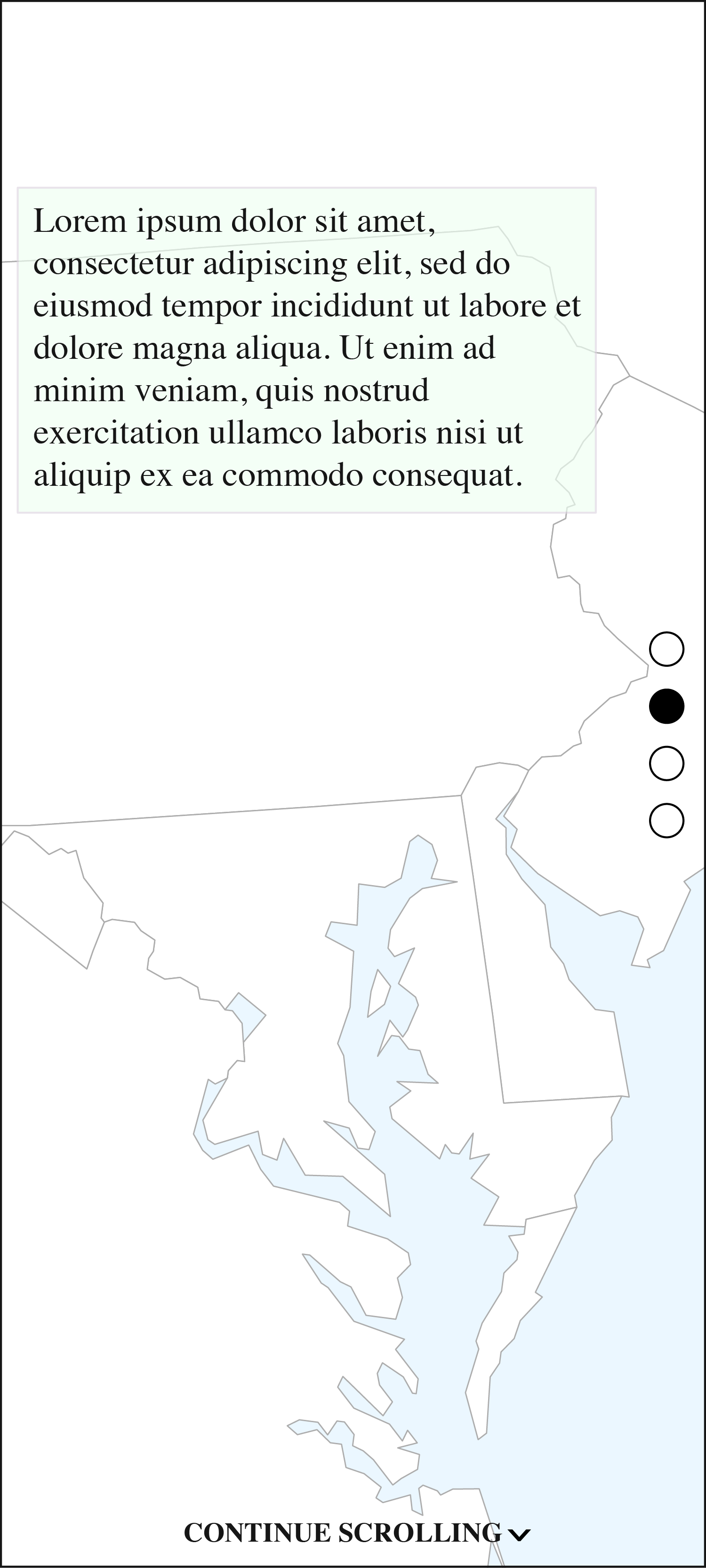
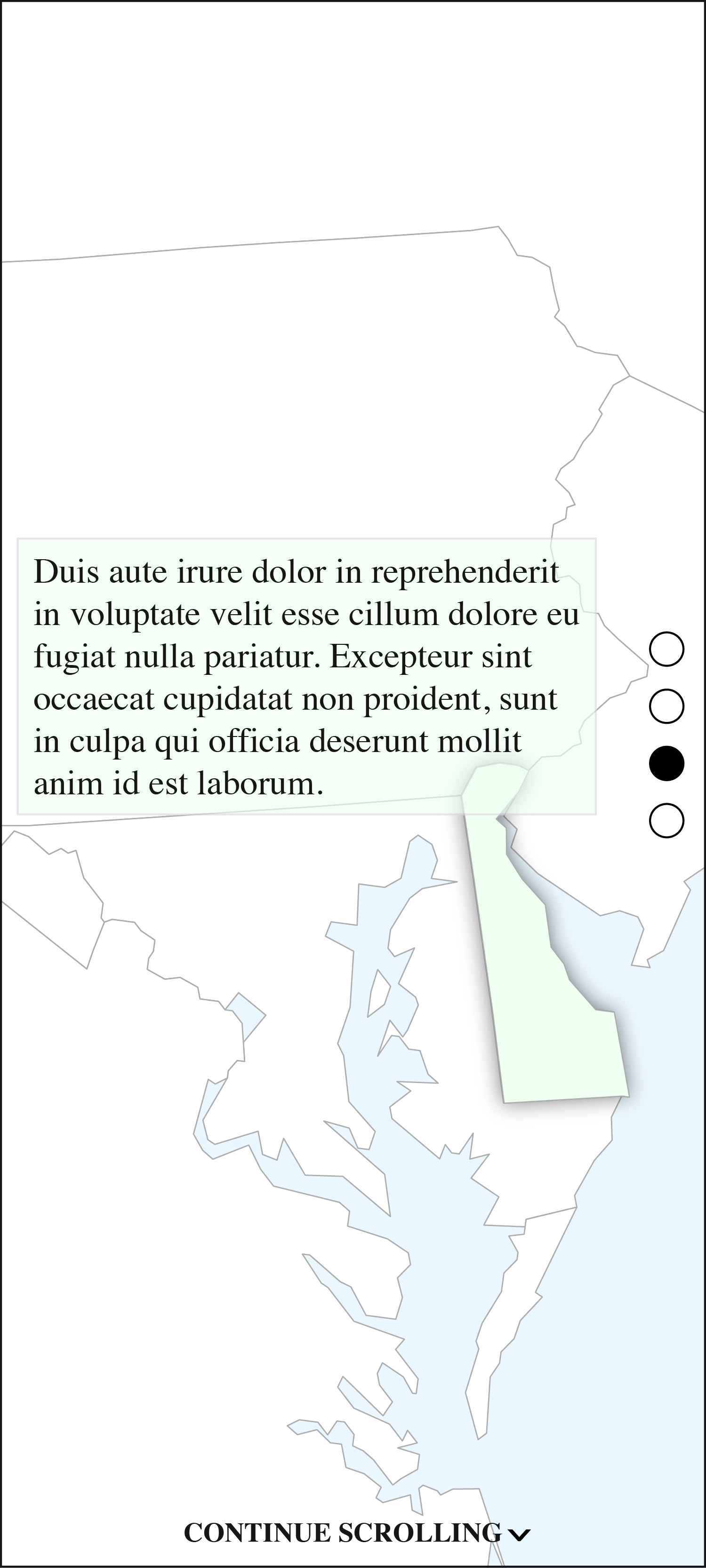
The panels to the right demonstrate the concept of "scrollytelling", a common technique in mobile data journalism. As the user scrolls, features on the map change and text moves, as opposed to more complex forms of interaction.
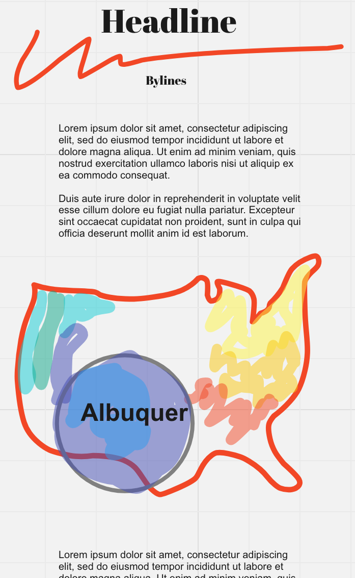
As part of my interviews, participants drew their vision for the future of mobile map design. This example seeks to solve the problem of data that is too small and hard to read on a mobile device by incorporating a fisheye zoom.
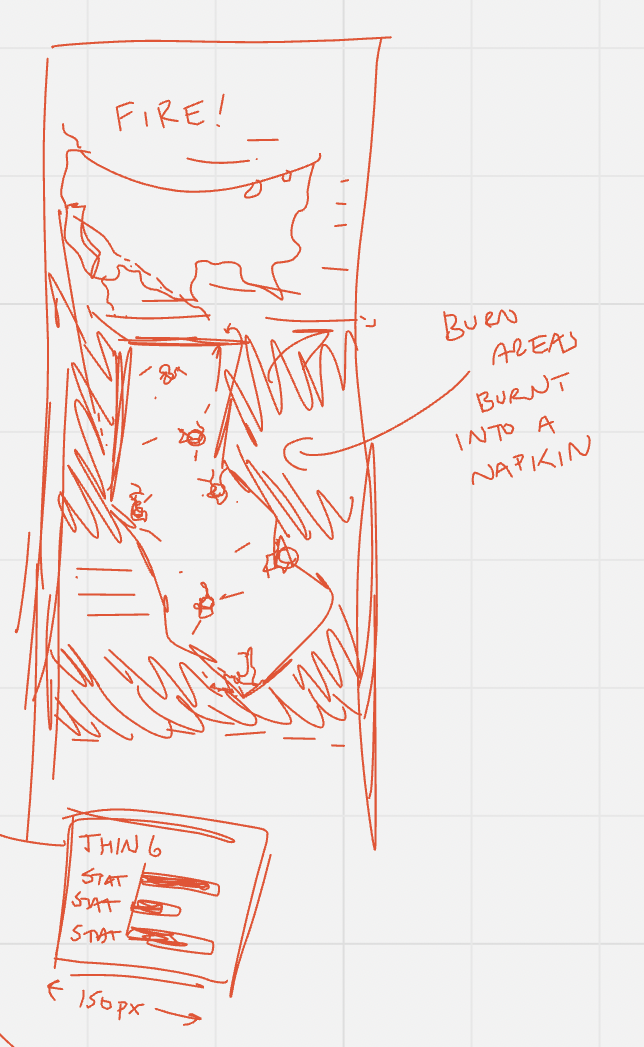
This example, created by a different data journalist, attemps to draw mobile users into the story by using a novel design technique. Instead of only producing a digital image, the journalist suggests burning fire data into a napkin.
Paper Abstract: Maps are increasingly read on mobile devices. Mobile maps necessitate specific design considerations to improve readability and user experience. Little research has focused on how to design mobile thematic maps, in contrast to reference maps. Data journalism represents a common way that the public encounters mobile thematic maps. This paper characterizes the design techniques and challenges associated with mobile thematic cartography in the context of data journalism. Through interviews with 18 expert news cartographers, I show that teams of data journalists are increasingly aware of mobile users, but face numerous constraints when designing for these users. They face time constraints, the need to design for both desktop and mobile, and must reach vast general audiences, meaning they often practice simultaneous design over mobile-first design. News cartographers have also reduced their use of interactivity, which reduces complexity related to designing for both desktop and mobile. This work shows that news cartographers solve mobile thematic map design challenges through iterative design processes that draw from years of expertise, not a strict set of guidelines.